MariaDB Geospatial – Empowering Missions in Real-Time with CubeWerx
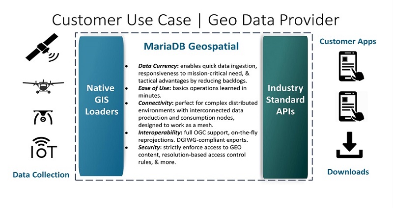
Looking to turn your raster and vector geospatial data into open web services? MariaDB Geospatial integrated solution comes equipped with all the necessary components for effectively managing massive data collections and publishing them via standard APIs. As a data publishing platform specifically built to handle massive geospatial data sets and support open web services frameworks, MariaDB Geospatial is ideally suited to meet these challenges. The system provides an unparalleled capability to reduce the delays, inefficiencies and bottlenecks between data collection and delivering timely GEOINT to decision-makers.
The MariaDB Geospatial platform, powered by the secure MariaDB Enterprise Server backend, is STIG Certified to meet DOD data security requirements. Designed with a commitment to open standards, it provides extensive capabilities for collaborations and cooperation between operations centers internally and allied systems, maintaining full compatibility with all existing standards-compliant applications.
MariaDB Geospatial complements and optimizes your investment in ESRI. While ESRI has proven to be an excellent geospatial framework, the escalating volume of geospatial data highlights scalability limitations to handle the magnitude of today's data explosion, particularly struggling with the demands of the largest geospatial datasets. In contrast, the synergy of MariaDB Enterprise Server and CubeWerx offers a scalable solution, ensuring access to real-time data. This is critical in the current global conflicts, where decision-makers require the latest, real-time information.