

Explore Google's Self-Guided Tours
Google and Carahsoft have partnered together to provide a series of self-guided tours of Google's products and features. Similar to a live demo, the self-guided tours explores how Google's products and features applies to a specific technology vertical such as MultiCloud & Geospatial.
Learn about Google's benefits, watch a short pre-recorded demo video, and download related resources. If interested in furthering the conversation, you can also schedule a live demo with a Google expert from Carahsoft. Start a Self-Guided Tour now by selecting one below:
Google MultiCloud Self-Guided Tour
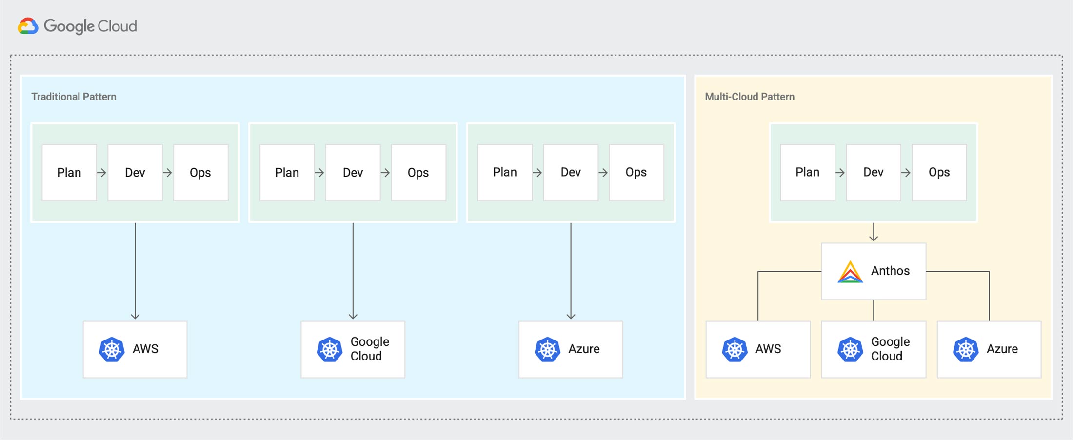
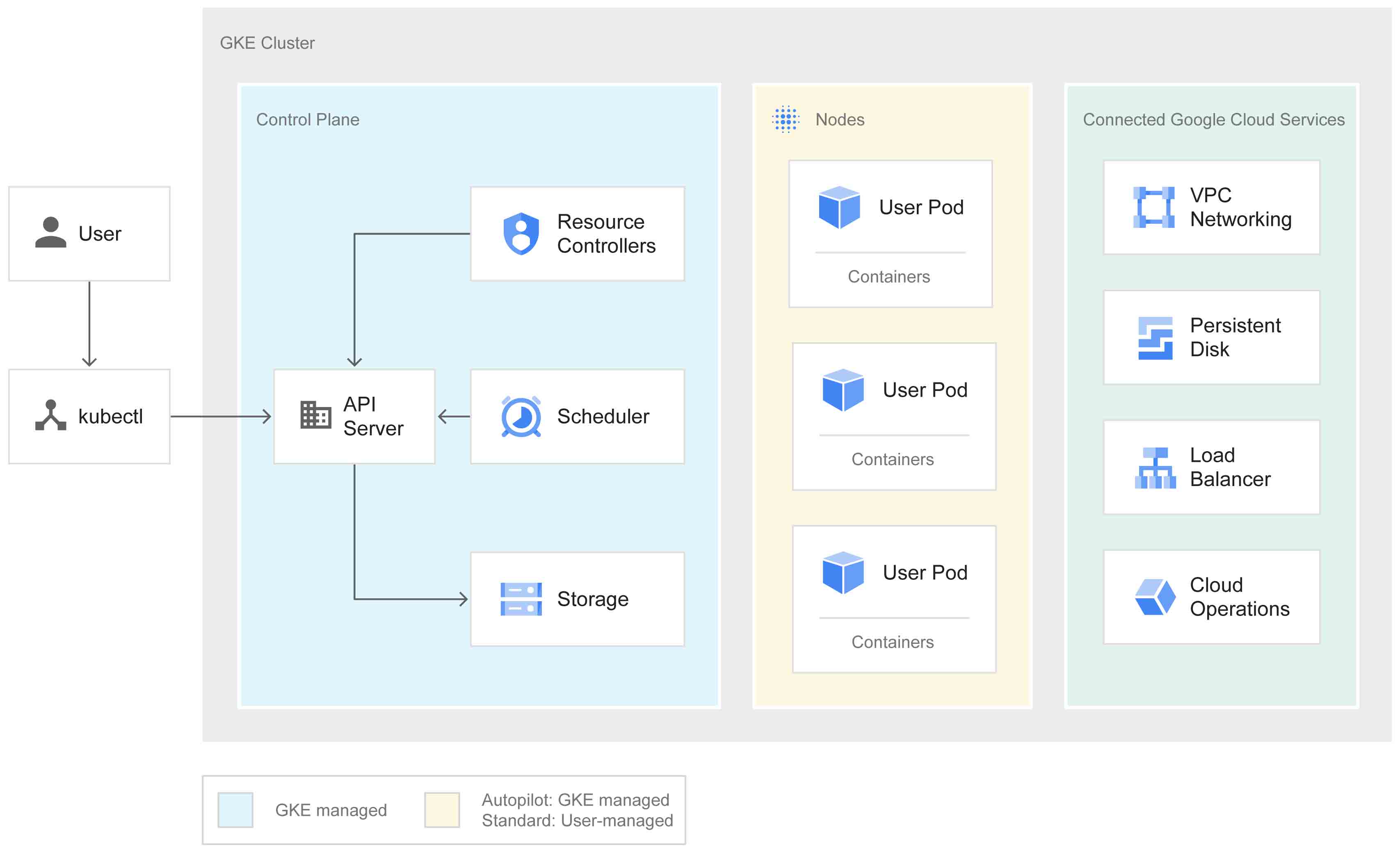
Google Cloud offers a versatile solution for managing applications and data across various cloud environments, enabling agility and modernization. With Google Cloud, Government agencies can seamlessly build and enhance apps while leveraging the benefits of multicloud deployment. The platform ensures consistency and provides comprehensive data analysis regardless of where your deployments reside, offering a service-centric view across all environments. By integrating Google Cloud with Oracle Cloud Infrastructure (OCI), agencies can create a robust multicloud solution that capitalizes on the unique strengths of each platform. This cloud connection establishes a resilient multicloud Oracle environment and simplifies management complexity through a unified data protection strategy.
Want to learn more about Google?
Start a self-guided demo now to learn more about Google’s multicloud solutions and how they help agencies manage their cloud environment.
Google's Benefits Snapshot:
- Uncover new insights and break down silos across clouds.
- Accelerate application delivery with best-in-class managed Kubernetes and serverless platform.
- Leverage flexible, open technology to maximize choice and increase IT investments’ longevity.

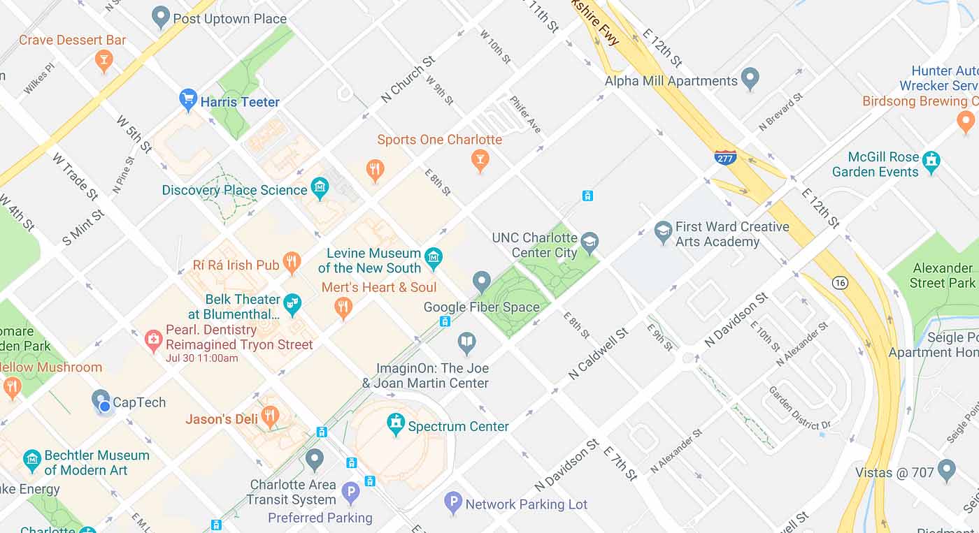
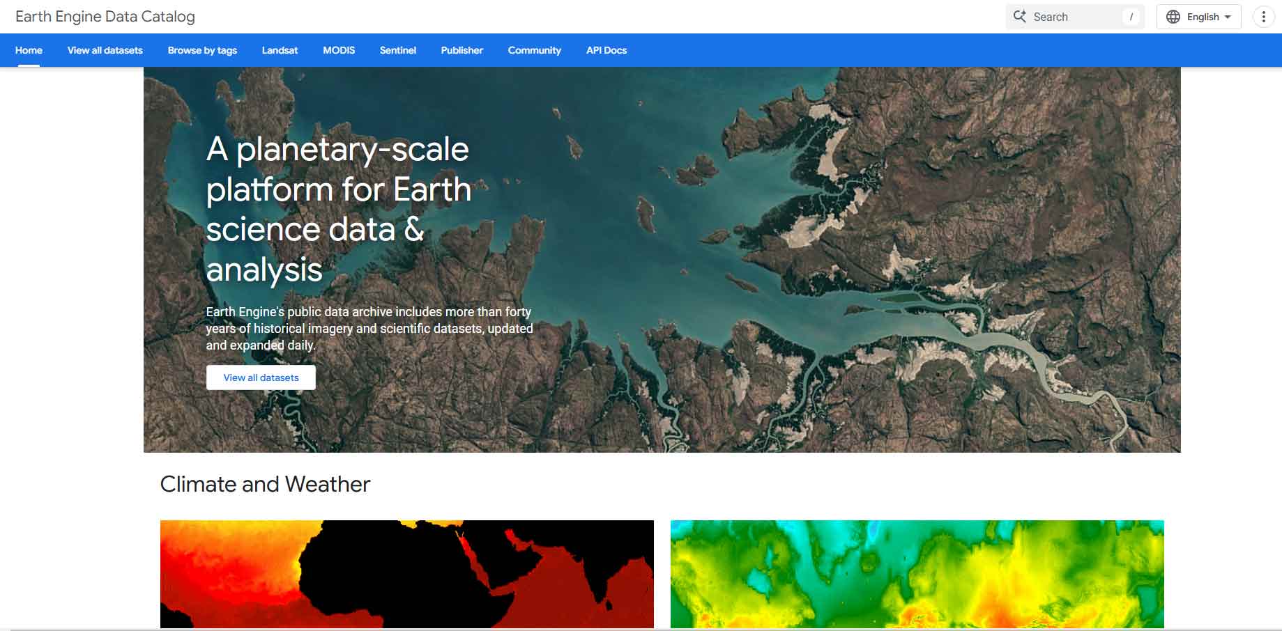
Google Maps Geospatial Self-Guided Tour
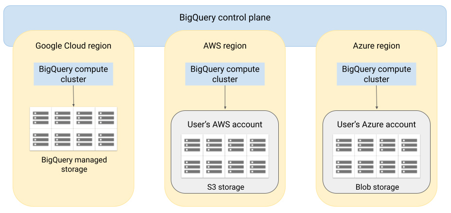
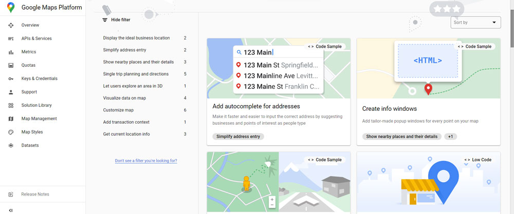
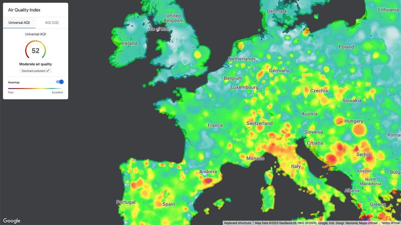
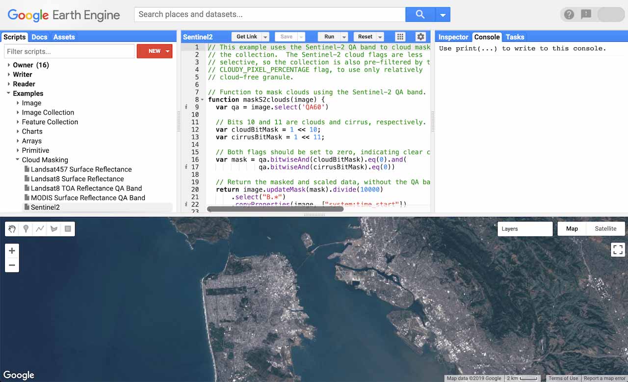
Solve common geospatial use cases at scale with Google Maps' advanced AI and analytics. These tools improve constituent experiences and productivity with AI-powered contact centers, reducing costs and freeing up human agents for more complex tasks. BigQuery offers a cost-effective, serverless data warehouse that functions across clouds, while Translation Hub facilitates content translation into 135 languages with an intuitive interface. By decreasing manual labor, Government agencies can expedite critical service delivery.
Enhanced analytics and AI help optimize operations and resource efficiency, meeting constituent needs effectively. Solutions like GDC Hosted provide secure cloud environments for sensitive data, and Anthos supports the scalable deployment of modern applications. With robust API management and modern security measures, agencies can protect critical systems and data. Additionally, Google Cloud enables cloud migration, research breakthroughs and improved communication and collaboration, ensuring business continuity and heightened security against threats.
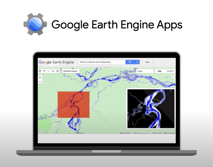
Want to learn more about Google Maps?
Start a self-guided demo now to see how people are using Google Maps to explore the world around them, put their communities on the map and help others.

Google Maps’ Benefits Snapshot:
-
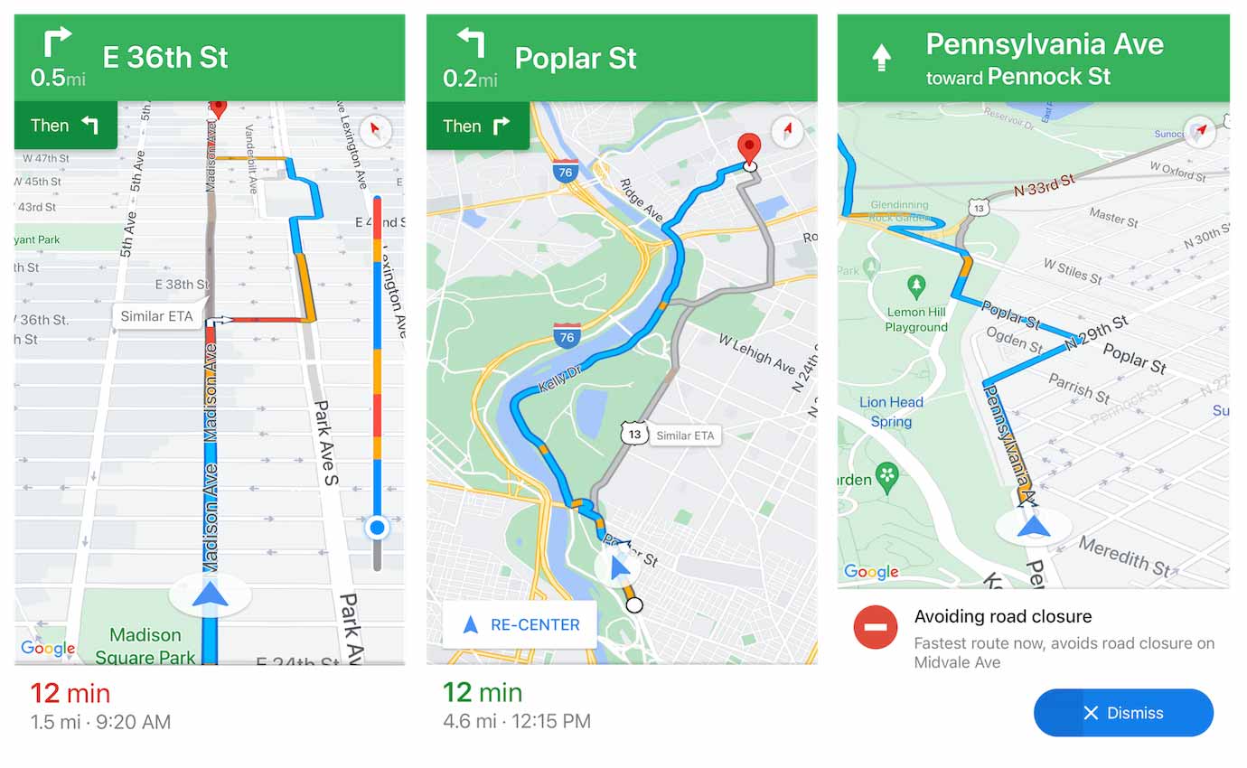
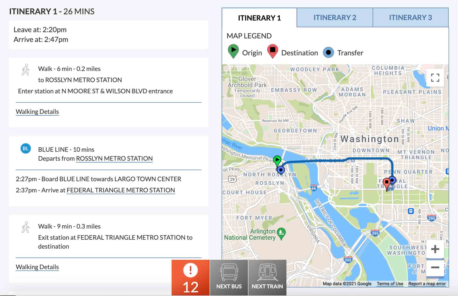
Google Maps streamlines navigation and access to Government services, enhancing the citizen experience.
-
Google Maps’ use of Gen AI optimizes route planning, reduces travel costs and automates tasks, boosting productivity and efficiency.
-
Google Maps’ analytics and AI capabilities uncover insights into citizen behavior, traffic patterns and service usage, empowering informed decision-making for better resource allocation.